
We are staying for a few days at Lyman Lake State Park in Eastern Arizona not far off the border with New Mexico. This image shows a peninsula that reaches out into the lake; you can barely see the water on the right side of the image. The water level is down but rising. The lake partially encircles this peninsula. There is a trail system that wraps around this peninsula and wanders through various parts of the rock strewn terrain. The trail-head, parking area, and informational kiosk are located in about the center of this image at the end of the gravel road.

Here we are at the start of the trail that is just to the left in this picture. There are some petroglyphs located along the trail hence the name petroglyph trail. We called it the flat rock trail for obvious reason that we shall see.

Here are Deanna and the boys eager to start off on the trail.

At numerous points along the trail we find these flat rocks that provide bridges across small but now dry water ways. This is monsoon country and though the landscape does not look like it now, in the summer they will get drenching rains that course down the hillside and run off into the lake.

Another major use of the flat rocks is for stairs. Lots of them as you climb and descend the various portions of the trail. The trail is extremely well done.

Yogi is seen in this picture getting some help from Deanna. He is going on 15 years old and some of the stairs were a little high for his old bones to navigate. He ended up doing remarkably well considering his age and the problems that he has with his hips.

This provides a view of one section of the trail. It is smooth at times and mostly flat rock stairs at others. It climbs and winds to the left in this image.

You will see this identical sign at two locations, once at the start of the trail and here where a side path leads to some of the petroglyphs. There is another area of extensive petroglyphs located across the lake. We did not have access to a boat, they were not yet running the tours to that area, and we chose not to swim there hence, we will save viewing those petroglyphs for another time.

Here are some of the petroglyphs. Some are faded and a little hard to see in this light. Ancient people chipped away the patina on the stone to form these images. There are several interpretations as to their exact meaning.

A close up of one of the petroglyphs. This one appears to be perhaps a deer?

At the kiosk at the start of the trail there is this sign. It is a drawing of this section of rock art and shows many of the drawings that were not adequately viewable in the photograph.

Did we say stairs? There are lots of them here, no escalators to be found. After the petroglyphs the trail continues on, up these stairs.

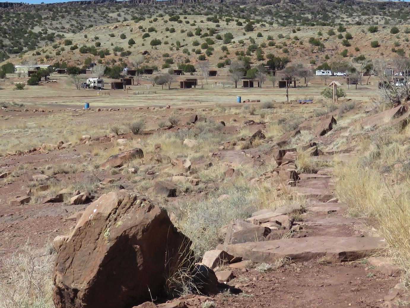
We climbed up and continued along the trail. We looked back to the west for a view of the camping area. Our trailer is on the very left side of this image. There are not many campers here at this time. Each campsite that you see here has a little cabana that would provide some reprieve from the summer sun, a heavy seemingly new picnic table, a fire ring for campfires, and a sand area for pitching a tent.. The camping facilities are very well done with bathroom and shower facilities available at different locations.

Up on top now and there are some piles of rocks. Note the layered structure of the rocks.

We could see part of an opening in the rocks above and there was a separate side trail leading to them. Here we have a better view of that opening; you can see that it goes completely through the rocks.

This is just a view of the lake continuing to the north. One of the publications indicated the lake had a surface area of 1200 acres. Obviously that would depend on the drought conditions. We were told the lake had been really low in the past few years but was coming up due to the large snow pack that was starting to melt.

We see the trail continuing on. It is not all stairs and not all flat surface, a mixture.

We have traversed around the corner of the peninsula and are looking more towards the south. The lake extends off into the distance and goes quite a bit further than we can see here. There is a road that traverses the west side of the lake and provides access to the south end and terminates an old Indian Pueblo located at Rattlesnake Point.

Continuing on around the trail we come back into view of the campground to the west.

We are not finished quite yet, there are still a few more stairs and flat rocks to navigate.
This is the last section of the trail. Almost back to the start now. We can see the kiosk located at the start of the trail.

This was just a funny sign we noticed near the parking area at the start of the trail. There is no swimming here now due to the low water level but as mentioned earlier the water is rising, hence the sign will be more useful later in the year..
We hope you enjoyed a brief look at the Petroglyph Trail. It was a fun adventure and we all successfully completed the circumnavigation of all the stairs and flat rocks.
As always, let us know if you have any questions or comments – All the best – George and Deanna
Marvelous! Thank you so much!!
ReplyDeleteSigne